Make sense of the world’s data
Danti searches and understands the massive amounts of data being collected on Earth so anyone can access decision-making information regardless of title or expertise.
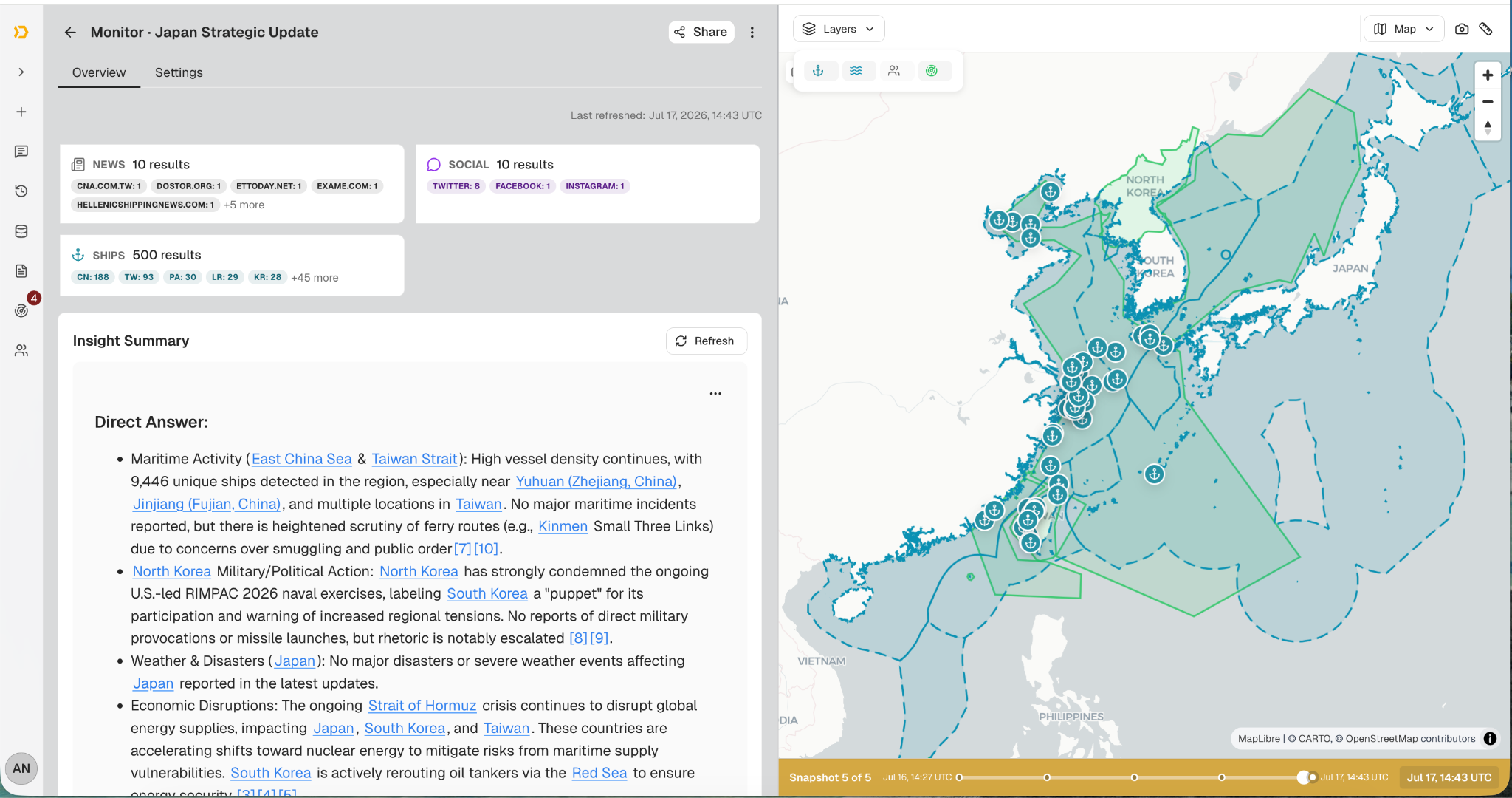
Ask Danti
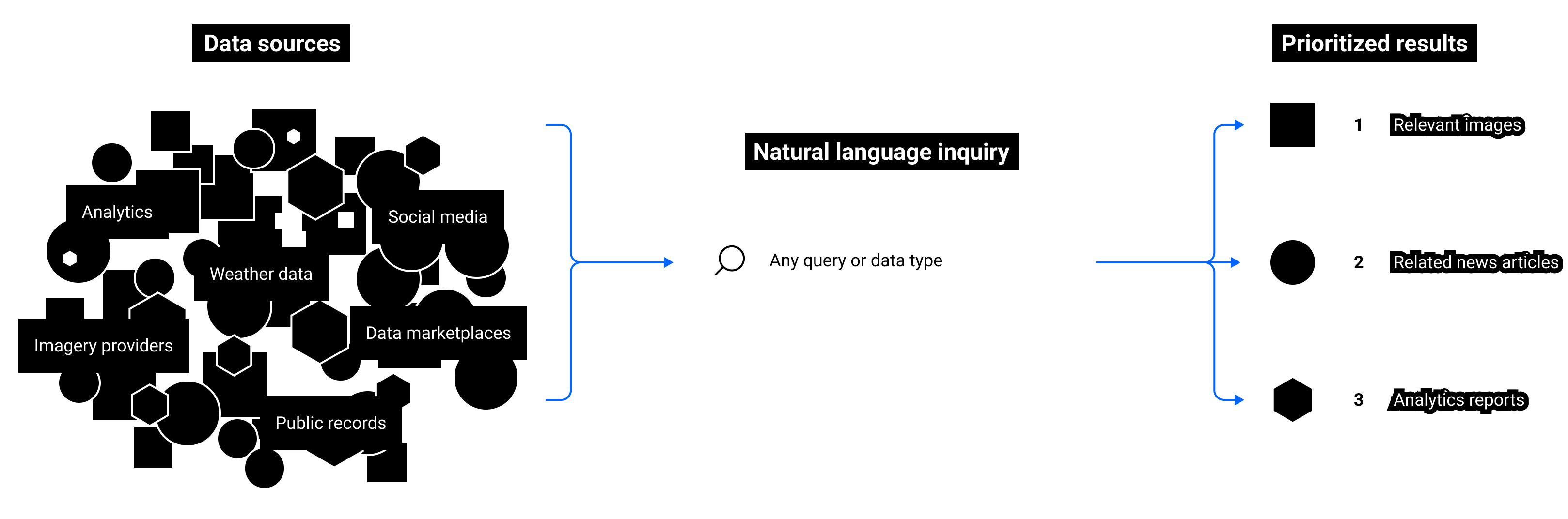
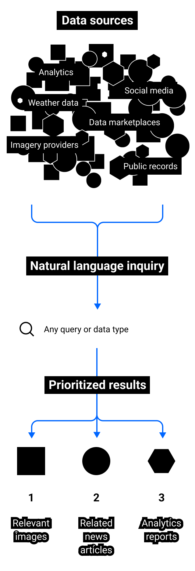
Simply ask a question like you would search the internet and Danti synthesizes data from diverse sources, including imagery, news, social media, shipping data and your unique data sources to get you the answers you need in seconds.
MULTI-INT AT YOUR FINGERTIPS
Learn everything about any place on Earth
Machine learning querying makes everybody an expert
Contextual results intelligently link related images, reports, analysis etc.
Accessible on the web or deployable inside your organizational firewalls
Intel for federal and commercial use

Defense & Intelligence
We give defense and intelligence organizations the power to access the data they need without making special requests to geospatial analysts or partners. We empower novice end users to search with the skill of experts with decades of experience and share data with allies and partners.

Property & Insurtech
Our technology can benefit realtors, insurers, developers, and investors looking to market or understand a property. Users can pose simple questions and understand properties, neighborhoods, cities, and counties.

Infrastructure
Enabling companies with large amounts of internal data sets to more easily search and make sense of the data they have, along with discovering what content lives in the outside world to better help them answer questions.
Working with the best

Featured In